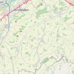
Die Karte wird geladen …
{"minzoom":false,"maxzoom":false,"mappingservice":"leaflet","width":"320px","height":"350px","centre":{"text":"","title":"","link":"","lat":48.28,"lon":14.3,"icon":""},"title":"","label":"","icon":"","lines":[],"polygons":[],"circles":[],"rectangles":[],"copycoords":false,"static":false,"zoom":11,"defzoom":14,"layers":["OpenStreetMap"],"image layers":[],"overlays":[],"resizable":false,"fullscreen":false,"scrollwheelzoom":true,"cluster":false,"clustermaxzoom":20,"clusterzoomonclick":true,"clustermaxradius":80,"clusterspiderfy":true,"geojson":{"type":"FeatureCollection","features":[{"type":"Feature","properties":[],"geometry":{"type":"LineString","coordinates":[[14.291581,48.290106],[14.285232,48.283138],[14.275278,48.276455],[14.275107,48.274798],[14.276737,48.262001],[14.275536,48.251943],[14.275448,48.24797],[14.274547,48.245283],[14.269742,48.240425],[14.265966,48.237109],[14.264551,48.236423],[14.262491,48.235394],[14.260689,48.234051],[14.257901,48.229906],[14.253439,48.225246],[14.252366,48.223359],[14.252538,48.221614],[14.254082,48.220013],[14.259831,48.215667],[14.260604,48.214008],[14.261204,48.208517],[14.260732,48.205886],[14.258587,48.197934],[14.258287,48.195589],[14.258416,48.189695],[14.260432,48.185261],[14.260689,48.183687],[14.259488,48.180797],[14.25725,48.17493],[14.252101,48.168806],[14.247082,48.164798],[14.244722,48.160934],[14.239745,48.155151],[14.238201,48.152202],[14.237689,48.148911],[14.236573,48.145074],[14.236917,48.14095],[14.238547,48.137857],[14.238118,48.134879],[14.228164,48.125025],[14.22301,48.121787],[14.216145,48.119667],[14.210053,48.116401],[14.20439,48.113965],[14.200786,48.1111],[14.198512,48.10471],[14.19774,48.098605],[14.199456,48.095109],[14.203017,48.089003],[14.20336,48.086853],[14.202745,48.084646],[14.202531,48.081234],[14.198539,48.073177],[14.197552,48.072087],[14.191203,48.069621],[14.188543,48.068187],[14.185025,48.065577],[14.178976,48.063053],[14.170652,48.061992],[14.166362,48.060472],[14.160356,48.059095],[14.15199,48.057919],[14.149716,48.057403],[14.139891,48.052928],[14.132254,48.049514],[14.129208,48.046789],[14.12539,48.041137],[14.123845,48.039099],[14.123116,48.036517],[14.119555,48.028223],[14.120585,48.022397],[14.120628,48.020072],[14.119126,48.015823],[14.118955,48.012809],[14.12007,48.008847],[14.118525,48.002214],[14.118783,47.995925],[14.121657,47.988257],[14.121786,47.986419],[14.12037,47.981018],[14.120606,47.978232],[14.123351,47.971337],[14.126054,47.9649],[14.125196,47.960935],[14.123995,47.957112],[14.120221,47.953721],[14.117046,47.951508],[14.1146,47.94711],[14.111854,47.938255],[14.110653,47.936214],[14.105205,47.925719],[14.104776,47.923073],[14.105634,47.919622],[14.109023,47.915739],[14.112283,47.912633],[14.115802,47.907541],[14.116402,47.906074]]}},{"type":"Feature","properties":{"title":"Kirchdorf/Krems","description":"Kirchdorf/Krems"},"geometry":{"type":"Point","coordinates":[14.116399,47.905758]}},{"type":"Feature","properties":{"title":"Schlierbach/Krems","description":"Schlierbach/Krems"},"geometry":{"type":"Point","coordinates":[14.110951,47.936588]}},{"type":"Feature","properties":{"title":"Nu\u00dfbach","description":"Nu\u00dfbach"},"geometry":{"type":"Point","coordinates":[14.123221,47.97171]}},{"type":"Feature","properties":{"title":"Wartberg/Krems","description":"Wartberg/Krems"},"geometry":{"type":"Point","coordinates":[14.121717,47.98797]}},{"type":"Feature","properties":{"title":"Kremsm\u00fcnster","description":"Kremsm\u00fcnster"},"geometry":{"type":"Point","coordinates":[14.140131,48.052928]}},{"type":"Feature","properties":{"title":"Rohr-Bad Hall","description":"Rohr-Bad Hall"},"geometry":{"type":"Point","coordinates":[14.1914,48.069621]}},{"type":"Feature","properties":{"title":"Kematen-Piberbach","description":"Kematen-Piberbach"},"geometry":{"type":"Point","coordinates":[14.203027,48.112877]}},{"type":"Feature","properties":{"title":"Neuhofen an der Krems","description":"Neuhofen an der Krems"},"geometry":{"type":"Point","coordinates":[14.238336,48.135737]}},{"type":"Feature","properties":{"title":"N\u00f6stlbach-St. Marien","description":"N\u00f6stlbach-St. Marien"},"geometry":{"type":"Point","coordinates":[14.246503,48.164039]}},{"type":"Feature","properties":{"title":"Nettingsdorf","description":"Nettingsdorf"},"geometry":{"type":"Point","coordinates":[14.258537,48.189581]}},{"type":"Feature","properties":{"title":"Ansfelden","description":"Ansfelden"},"geometry":{"type":"Point","coordinates":[14.261197,48.208603]}},{"type":"Feature","properties":{"title":"Traun","description":"Traun"},"geometry":{"type":"Point","coordinates":[14.253733,48.225388]}},{"type":"Feature","properties":{"title":"St. Martin bei Traun","description":"St. Martin bei Traun"},"geometry":{"type":"Point","coordinates":[14.264459,48.236294]}},{"type":"Feature","properties":{"title":"Linz-Wegscheid","description":"Linz-Wegscheid"},"geometry":{"type":"Point","coordinates":[14.275463,48.249427]}},{"type":"Feature","properties":{"title":"Linz-Oed","description":"Linz-Oed"},"geometry":{"type":"Point","coordinates":[14.276557,48.264499]}},{"type":"Feature","properties":{"title":"Linz-Hauptbahnhof","description":"Linz-Hauptbahnhof"},"geometry":{"type":"Point","coordinates":[14.291681,48.29019]}}]},"clicktarget":"","GeoJsonSource":"S-Bahn-Linie S4","GeoJsonRevisionId":122619,"imageLayers":[],"locations":[],"imageoverlays":null}