Die Karte wird geladen …
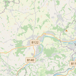
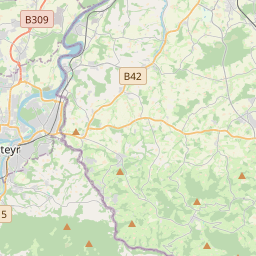
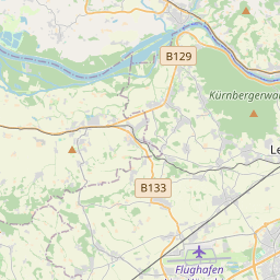
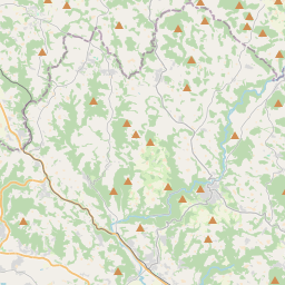
{"minzoom":false,"maxzoom":false,"mappingservice":"leaflet","width":"320px","height":"350px","centre":{"text":"","title":"","link":"","lat":48.28,"lon":14.3,"icon":""},"title":"","label":"","icon":"","lines":[],"polygons":[],"circles":[],"rectangles":[],"copycoords":false,"static":false,"zoom":11,"defzoom":14,"layers":["OpenStreetMap"],"image layers":[],"overlays":[],"resizable":false,"fullscreen":false,"scrollwheelzoom":true,"cluster":false,"clustermaxzoom":20,"clusterzoomonclick":true,"clustermaxradius":80,"clusterspiderfy":true,"geojson":{"type":"FeatureCollection","features":[{"type":"Feature","properties":[],"geometry":{"type":"LineString","coordinates":[[14.290222,48.288805],[14.294427,48.293945],[14.296692,48.29529],[14.299202,48.296246],[14.302099,48.296689],[14.304094,48.29636],[14.306368,48.295675],[14.30772,48.294876],[14.311603,48.292063],[14.312418,48.291121],[14.314027,48.286038],[14.316237,48.281255],[14.316859,48.277999],[14.317589,48.2752],[14.318189,48.274443],[14.319305,48.273158],[14.320742,48.26873],[14.327693,48.257431],[14.335567,48.253559],[14.341124,48.252216],[14.348054,48.251959],[14.35376,48.251087],[14.365517,48.247401],[14.379935,48.242743],[14.394008,48.238269],[14.410249,48.23291],[14.421878,48.229093],[14.427777,48.227221],[14.441079,48.222818],[14.445456,48.221617],[14.449811,48.220802],[14.455067,48.220645],[14.466674,48.221217],[14.475127,48.22146],[14.479117,48.221031],[14.484481,48.219987],[14.490939,48.218415],[14.495659,48.216756],[14.496388,48.216342],[14.500314,48.213854],[14.503168,48.210837],[14.507222,48.203801],[14.511792,48.196006],[14.517684,48.18585],[14.522017,48.178982],[14.524527,48.17416],[14.524399,48.172572],[14.522768,48.170468],[14.515367,48.166891],[14.504082,48.161695],[14.49359,48.156786],[14.48724,48.153894],[14.484751,48.15209],[14.482713,48.147867],[14.481919,48.145075],[14.481506,48.136241],[14.480777,48.133649],[14.479382,48.129653],[14.479404,48.128564],[14.480819,48.12411],[14.482193,48.122205],[14.493328,48.114799],[14.49569,48.112908],[14.49599,48.111705],[14.495733,48.110257],[14.49451,48.108022],[14.489468,48.104197],[14.484533,48.102262],[14.482174,48.102119],[14.478634,48.10199],[14.476166,48.101302],[14.474257,48.099855],[14.473463,48.094724],[14.472602,48.087056],[14.471701,48.084648],[14.47007,48.082699],[14.467088,48.081323],[14.464256,48.080735],[14.462132,48.078857],[14.461853,48.077337],[14.464256,48.074599],[14.464106,48.072921],[14.459322,48.067344],[14.456597,48.064447],[14.456082,48.063013],[14.452306,48.05263],[14.449298,48.047523],[14.447067,48.045558],[14.4393,48.043549],[14.43177,48.041369],[14.426642,48.040738],[14.42499,48.039819],[14.423017,48.038069],[14.419498,48.034726],[14.41834,48.032775],[14.418576,48.030536],[14.418812,48.028369],[14.418425,48.027207],[14.41731,48.026375],[14.412633,48.025097],[14.408299,48.023734]]}},{"type":"Feature","properties":{"title":"Garsten","description":"Garsten"},"geometry":{"type":"Point","coordinates":[14.408363,48.023705]}},{"type":"Feature","properties":{"title":"Steyr","description":"Steyr"},"geometry":{"type":"Point","coordinates":[14.42344,48.038385]}},{"type":"Feature","properties":{"title":"Steyr-M\u00fcnichholz","description":"Steyr-M\u00fcnichholz"},"geometry":{"type":"Point","coordinates":[14.449449,48.047839]}},{"type":"Feature","properties":{"title":"Ramingdorf-Haidershofen","description":"Ramingdorf-Haidershofen"},"geometry":{"type":"Point","coordinates":[14.459641,48.067645]}},{"type":"Feature","properties":{"title":"Dorf a. d. Enns","description":"Dorf a. d. Enns"},"geometry":{"type":"Point","coordinates":[14.473008,48.091256]}},{"type":"Feature","properties":{"title":"Ernsthofen","description":"Ernsthofen"},"geometry":{"type":"Point","coordinates":[14.480088,48.126531]}},{"type":"Feature","properties":{"title":"Herzograd","description":"Herzograd"},"geometry":{"type":"Point","coordinates":[14.503344,48.161252]}},{"type":"Feature","properties":{"title":"St. Valentin","description":"St. Valentin"},"geometry":{"type":"Point","coordinates":[14.522245,48.179083]}},{"type":"Feature","properties":{"title":"Ennsdorf","description":"Ennsdorf"},"geometry":{"type":"Point","coordinates":[14.496454,48.21637]}},{"type":"Feature","properties":{"title":"Enns","description":"Enns"},"geometry":{"type":"Point","coordinates":[14.46674,48.221074]}},{"type":"Feature","properties":{"title":"Asten-Fisching","description":"Asten-Fisching"},"geometry":{"type":"Point","coordinates":[14.427608,48.227178]}},{"type":"Feature","properties":{"title":"Linz-Pichling","description":"Linz-Pichling"},"geometry":{"type":"Point","coordinates":[14.379421,48.2428]}},{"type":"Feature","properties":{"title":"Linz-Ebelsberg","description":"Linz-Ebelsberg"},"geometry":{"type":"Point","coordinates":[14.347745,48.251902]}},{"type":"Feature","properties":{"title":"(geplant) Linz-Franckviertel","description":"(geplant) Linz-Franckviertel"},"geometry":{"type":"Point","coordinates":[14.30639,48.295589]}},{"type":"Feature","properties":{"title":"Linz-Hauptbahnhof","description":"Linz-Hauptbahnhof"},"geometry":{"type":"Point","coordinates":[14.291651,48.290179]}}]},"clicktarget":"","GeoJsonSource":"S-Bahn-Linie S1","GeoJsonRevisionId":122529,"imageLayers":[],"locations":[],"imageoverlays":null}
.jpg/)